
Session 1, Read and notice: A continent with many neighbors
Week 3 big question: How can map clues help us find land and water?
Start with a story (optional) Mai and the Two Waters — Read it hereMai’s paper boat needs a lake, so she and Grandma Yer explore a map.
North America has many countries.
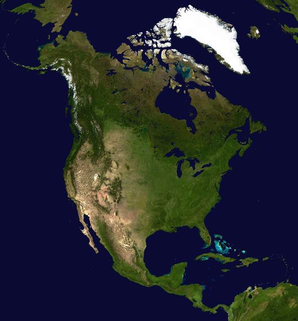
Imagine a trip across North America, with a map in your hands. Canada, the United States, and Mexico cover much of the mainland. Central America and the Caribbean islands belong to North America, too. There are many more countries to find. People live in big cities, small communities, and places in between. Even within one country, the land and ways of life can differ.
Oceans, lakes, and rivers are map clues.
Trace the coast to find three oceans touching this continent. The Pacific lies west, the Atlantic east, and the Arctic north. The five Great Lakes lie near the United States–Canada border. A border is a line between countries. They are Superior, Michigan, Huron, Erie, and Ontario. Their water flows toward the Atlantic through the St. Lawrence River. Farther inland lie the Mississippi and Missouri rivers. The Rio Grande forms part of the United States–Mexico border.
Mountains and map parts are clues, too.
Now look for the Rocky Mountains stretching through western North America. The Appalachian Mountains lie east, and the Sierra Nevada mostly in California. Feeling lost among the names? Start with the map’s title, then use its key to learn the symbols. Its direction arrow points north, while its scale compares map distance with real distance. Check its date to learn when someone made or updated it. Those clues can help you find your way.
Show what you notice
- Which ocean would you cross going west from California?
- How could a map’s scale and date help a traveler?
Answer your waypointact it outtell or dictatewrite